Map
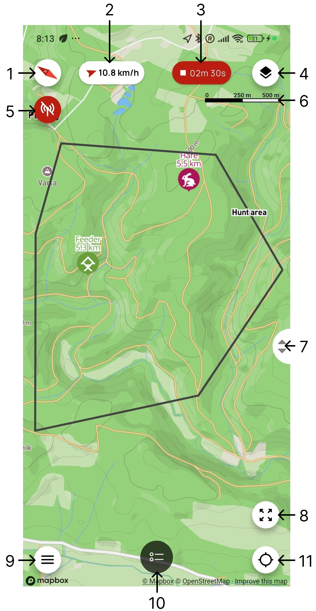
- Map orientation – indicates the direction of north. Tap the button to rotate the map so that north faces up.
- Wind – displays the wind direction and speed in km/h. Tap the indicator to open the weather forecast.
- Track recording – when recording is active, displays its elapsed time. Tap the button to pause, resume, or stop recording.
- Map layers – switches between four map types:
- Basic – an online map that requires the phone to be connected to the internet.
- Satellite – an online satellite map that requires the phone to be connected to the internet.
- Offline – a previously downloaded map that can be used without internet access.
- Custom – your own map uploaded in MBTiles format.
- Controller connection – indicates that no X30 or X40 controller is connected. Tap the button to open the list of found devices.
- Map scale – shows the relationship between a distance on the map and the actual distance.
- Map zoom – slide the control up or down to zoom the map in or out.
- Show all devices – centers the map and adjusts the zoom level to show all your devices (dogs and hunters).
- Menu – opens the app's main menu.
- Device list – tap the button to slide the device list up from the bottom of the screen.
- Multifunction button – performs one of three functions depending on the selected mode:
- Zoom to user location – centers and zooms the map on your location.
- North orientation – rotates the map so that north faces up.
- Rotate with phone – continuously rotates the map according to the direction in which the phone is pointing.
ATTENTION
Weather is available only when the user is signed in and the mobile app has access to the internet.